Kayak, Sail, Motorboat on Virginia's Eastern Shore
Author Archives: Tim
- June 4, 2024
0
- February 17, 2024
0
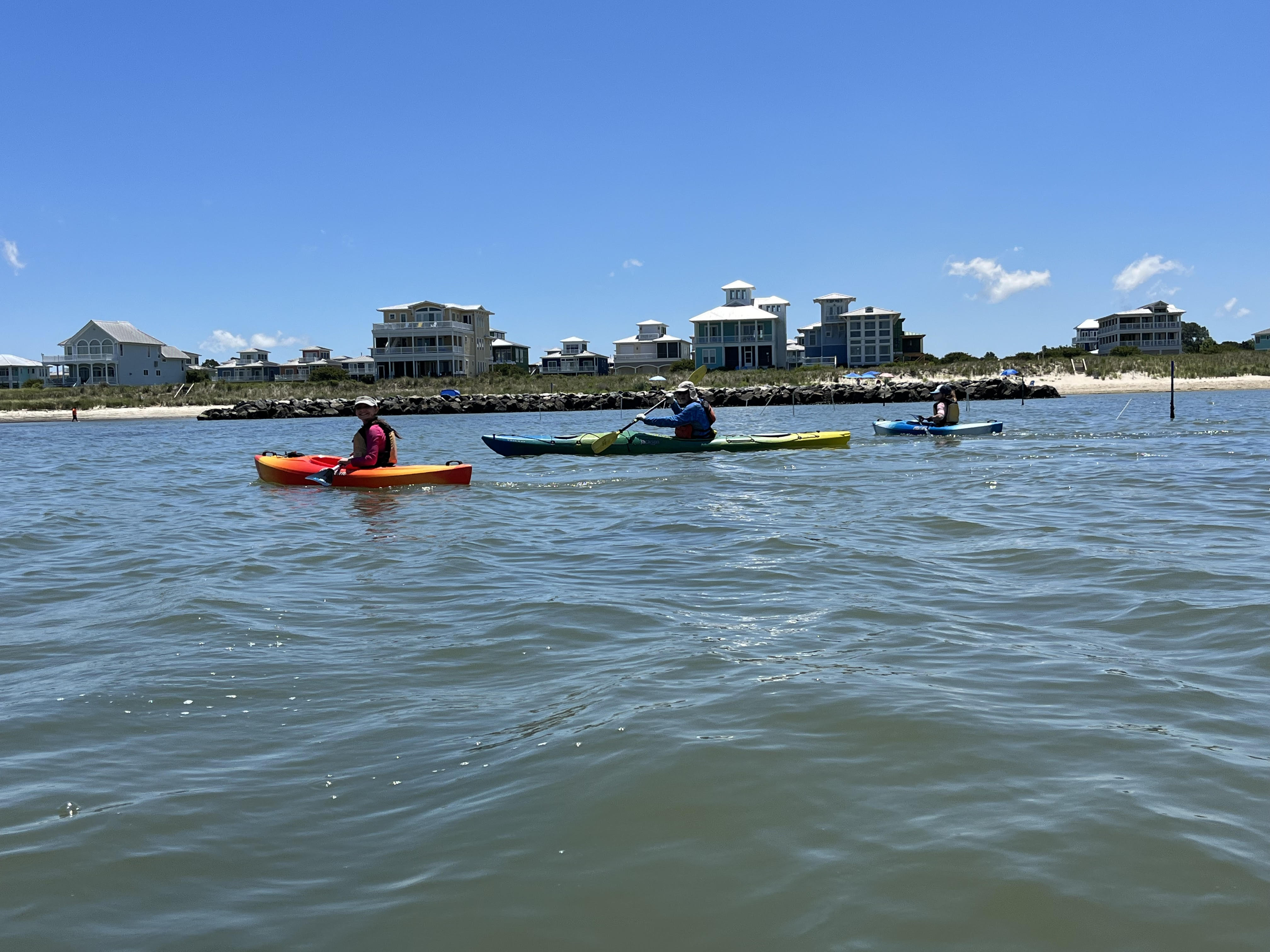
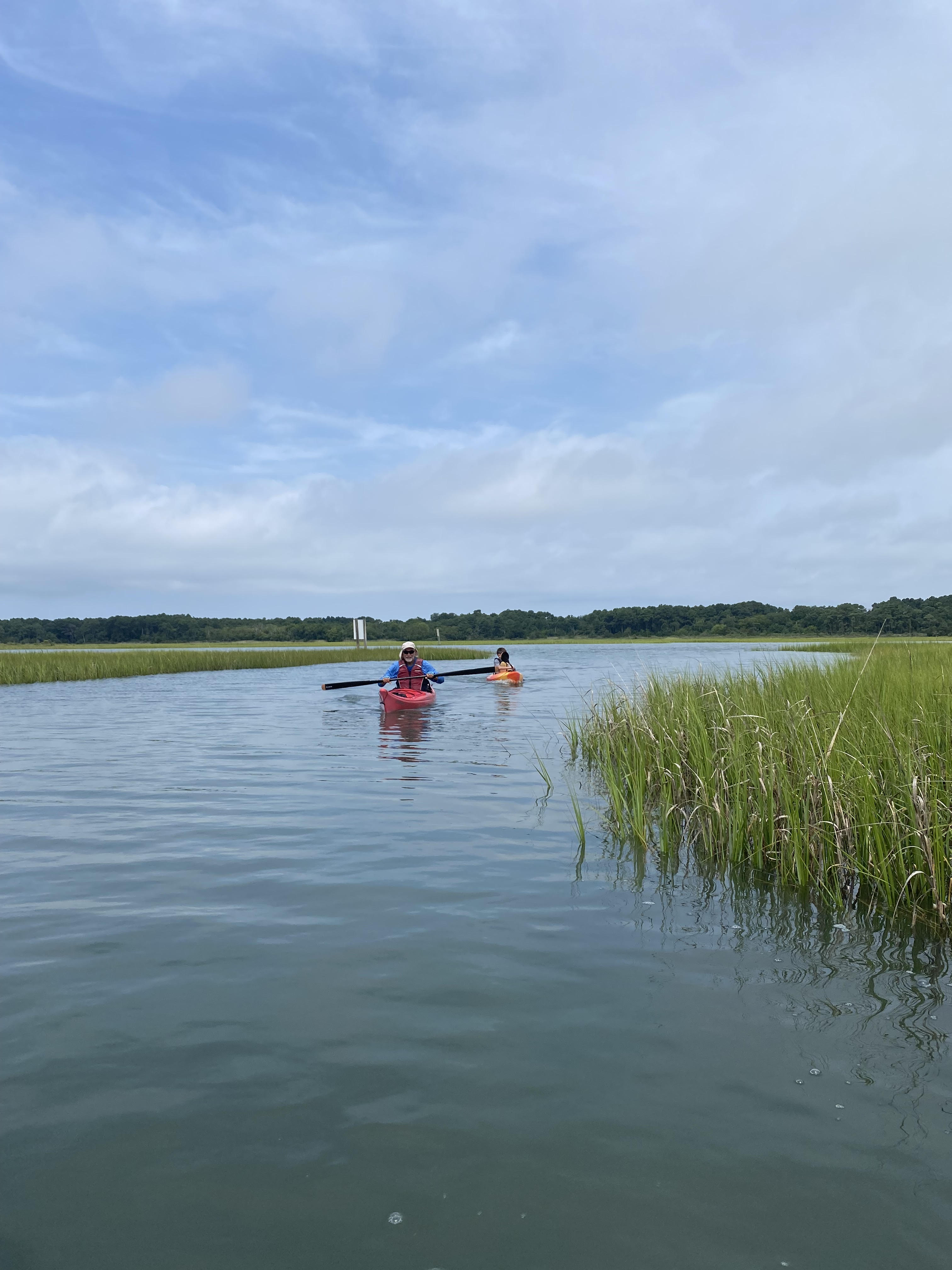
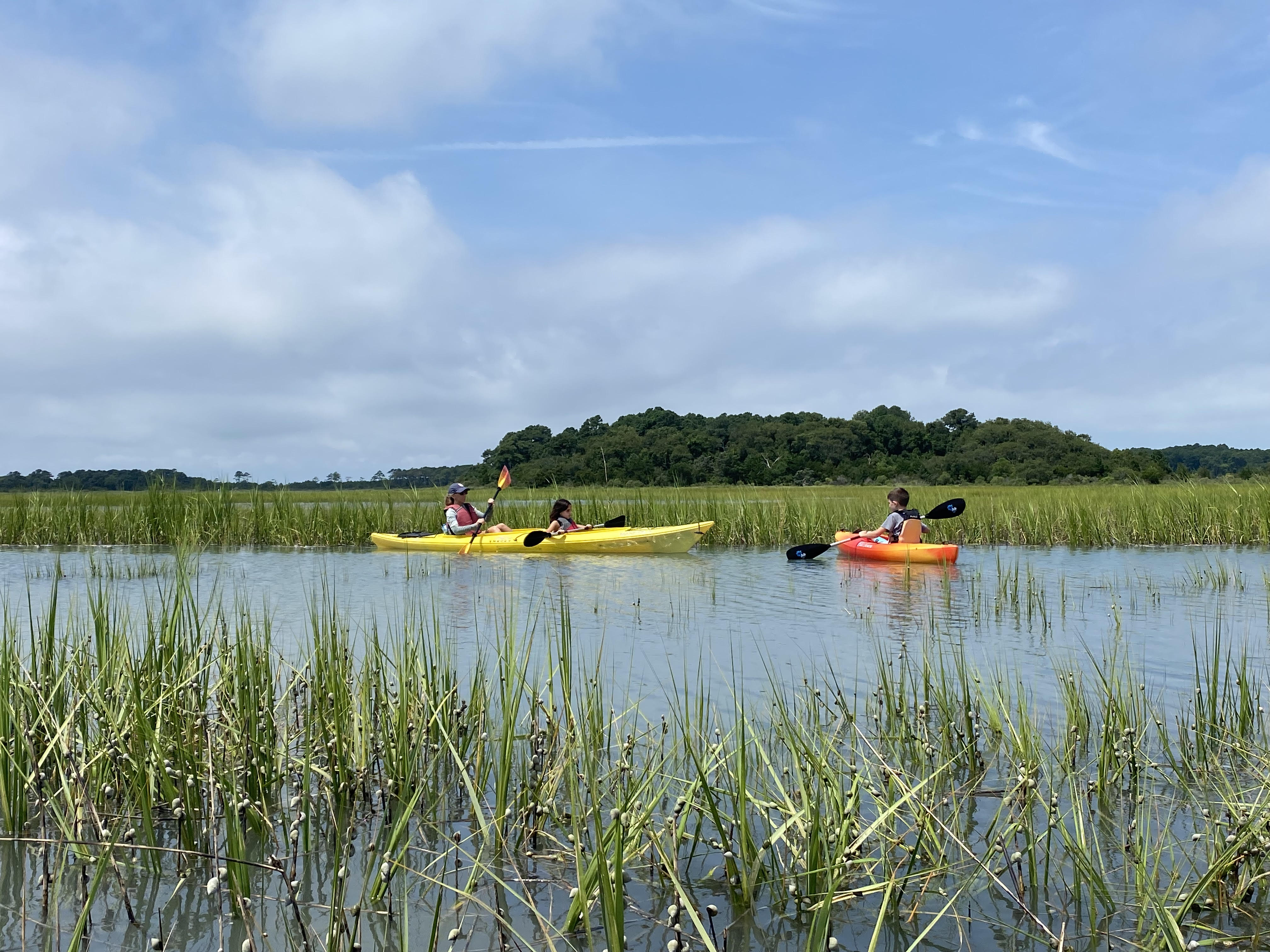
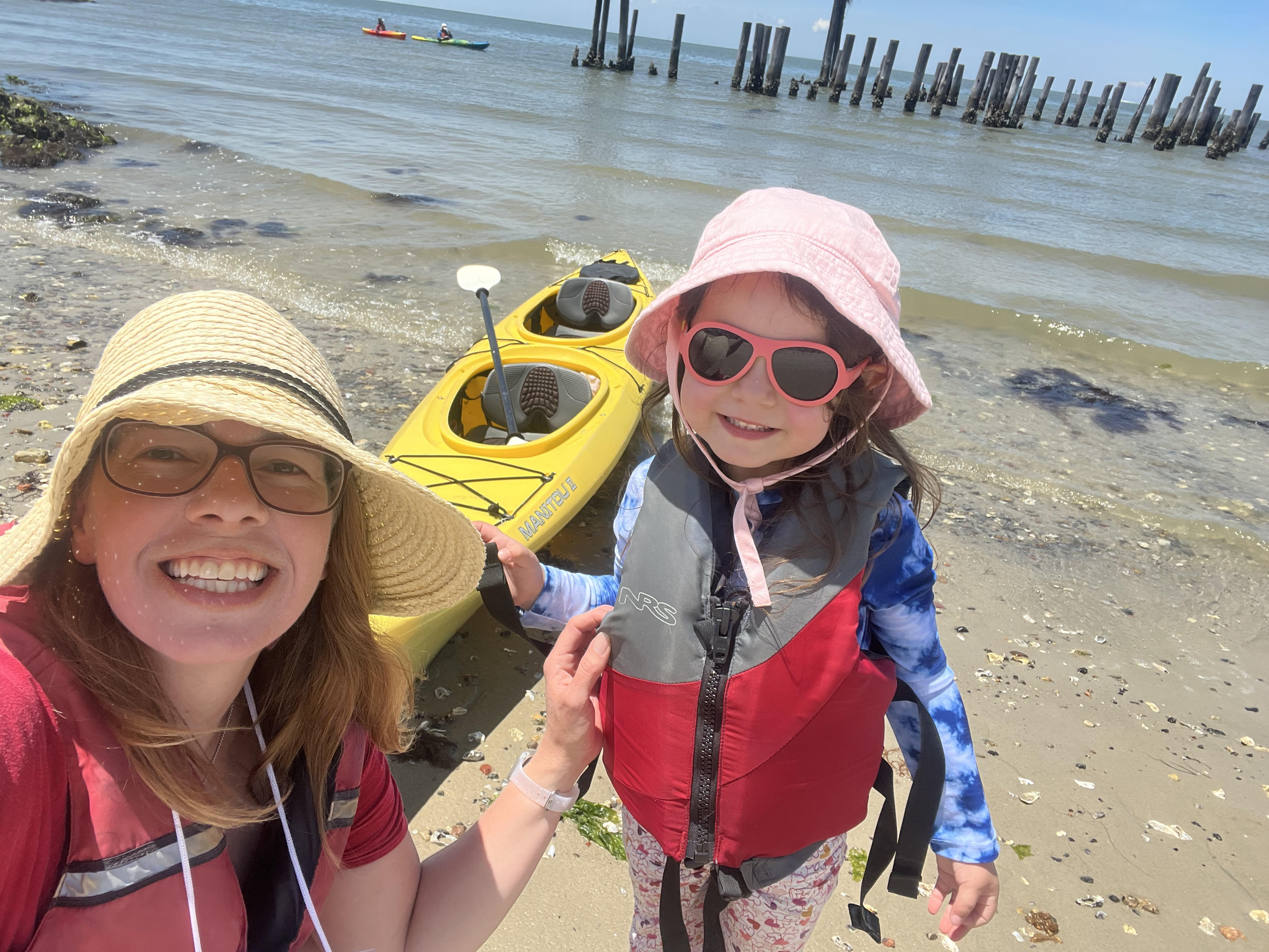
2023 Family Kayak Adventures
Category : Uncategorized
Summer is a great time to paddle the creeks and marshes and wander the beaches of the Eastern Shore. 2023 was no exception!
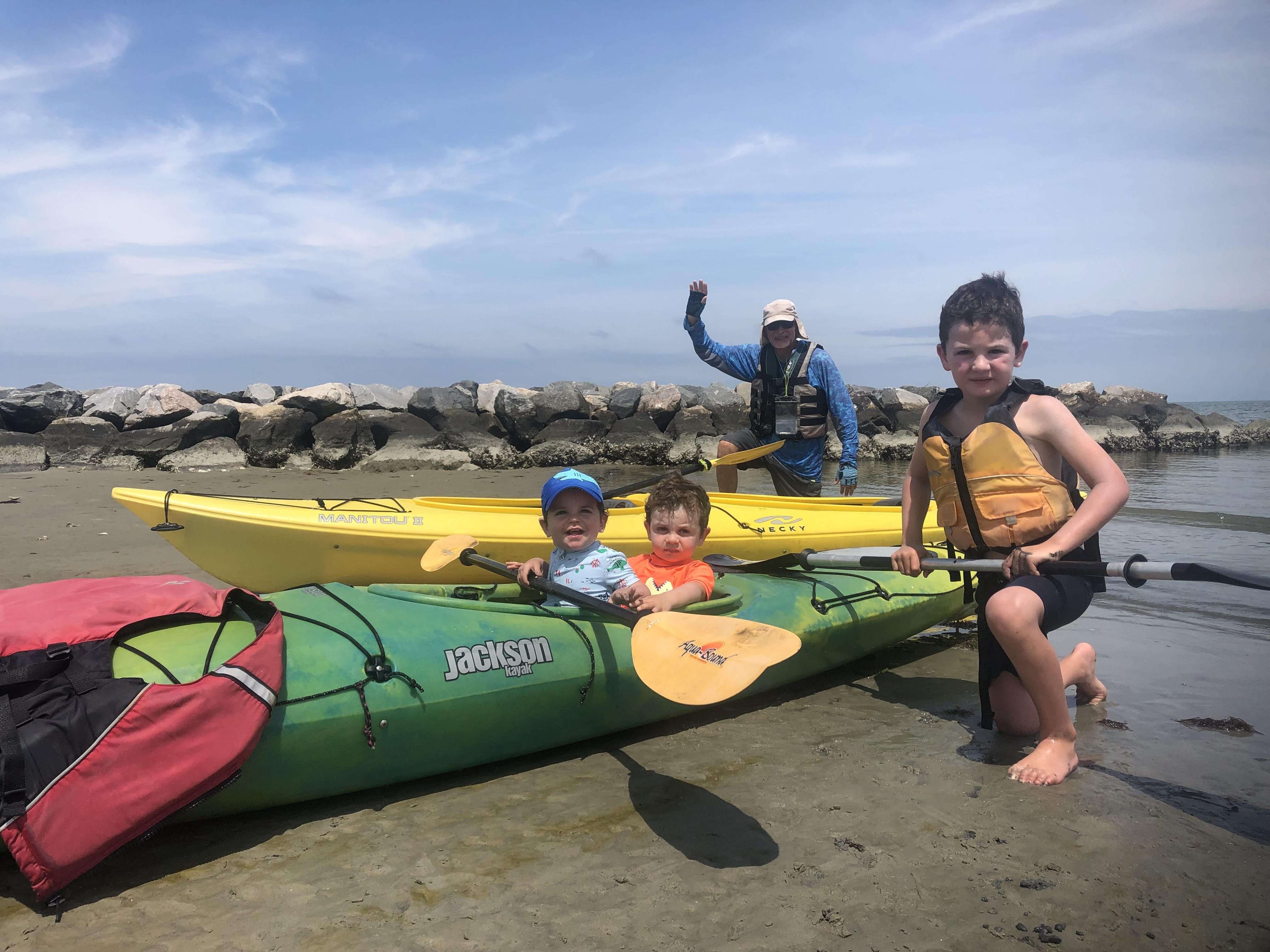
Ready to launch!

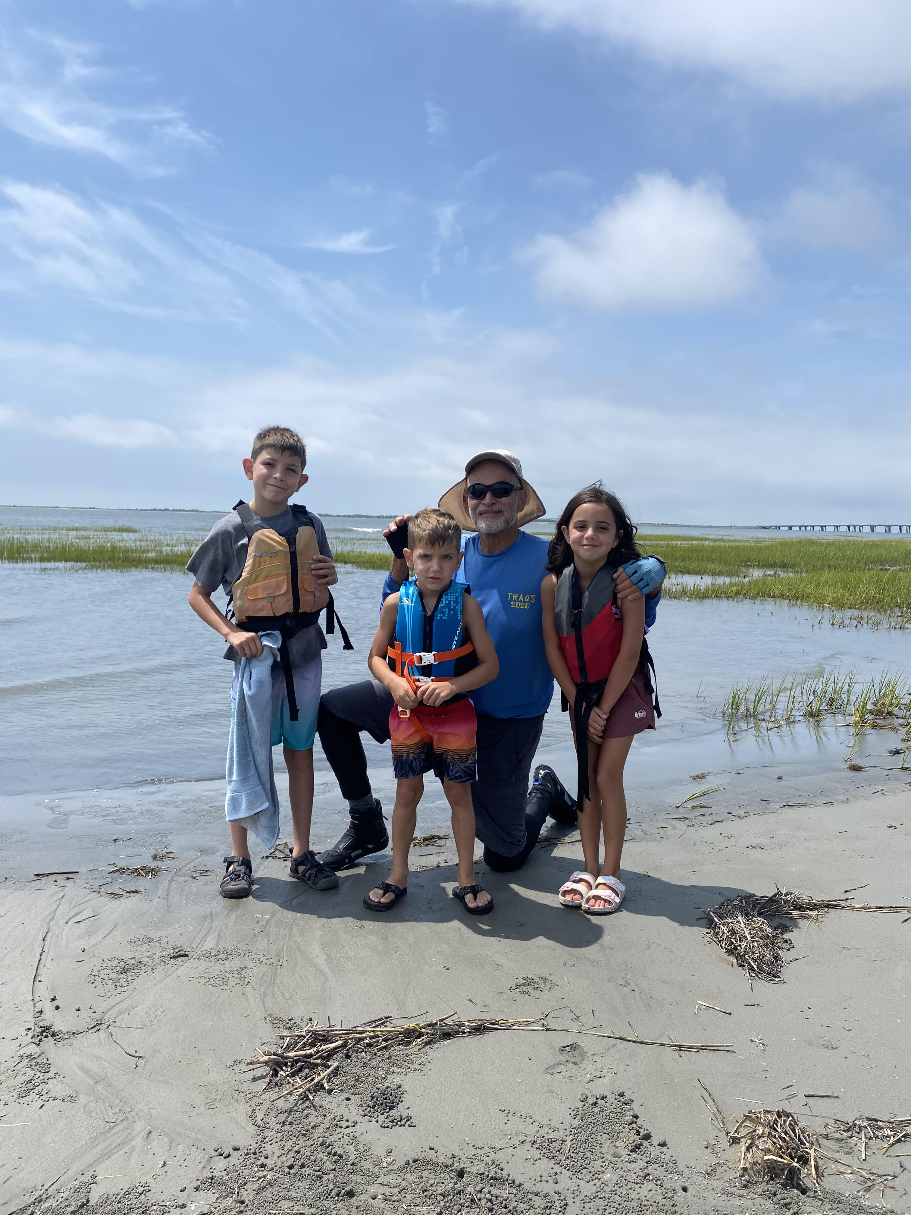
Exploring the beach!
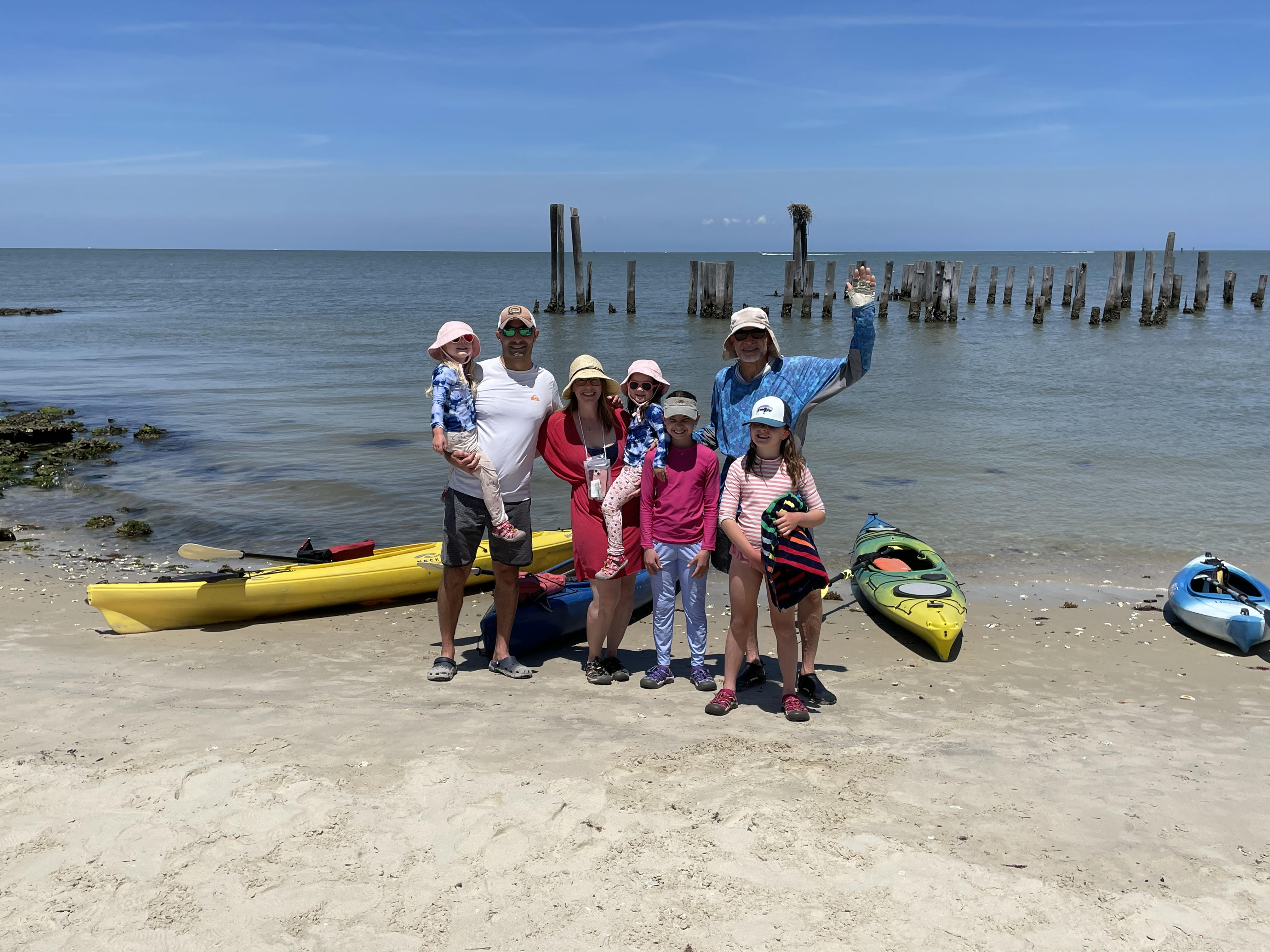
Family Adventure
Heading for Kings Creek!
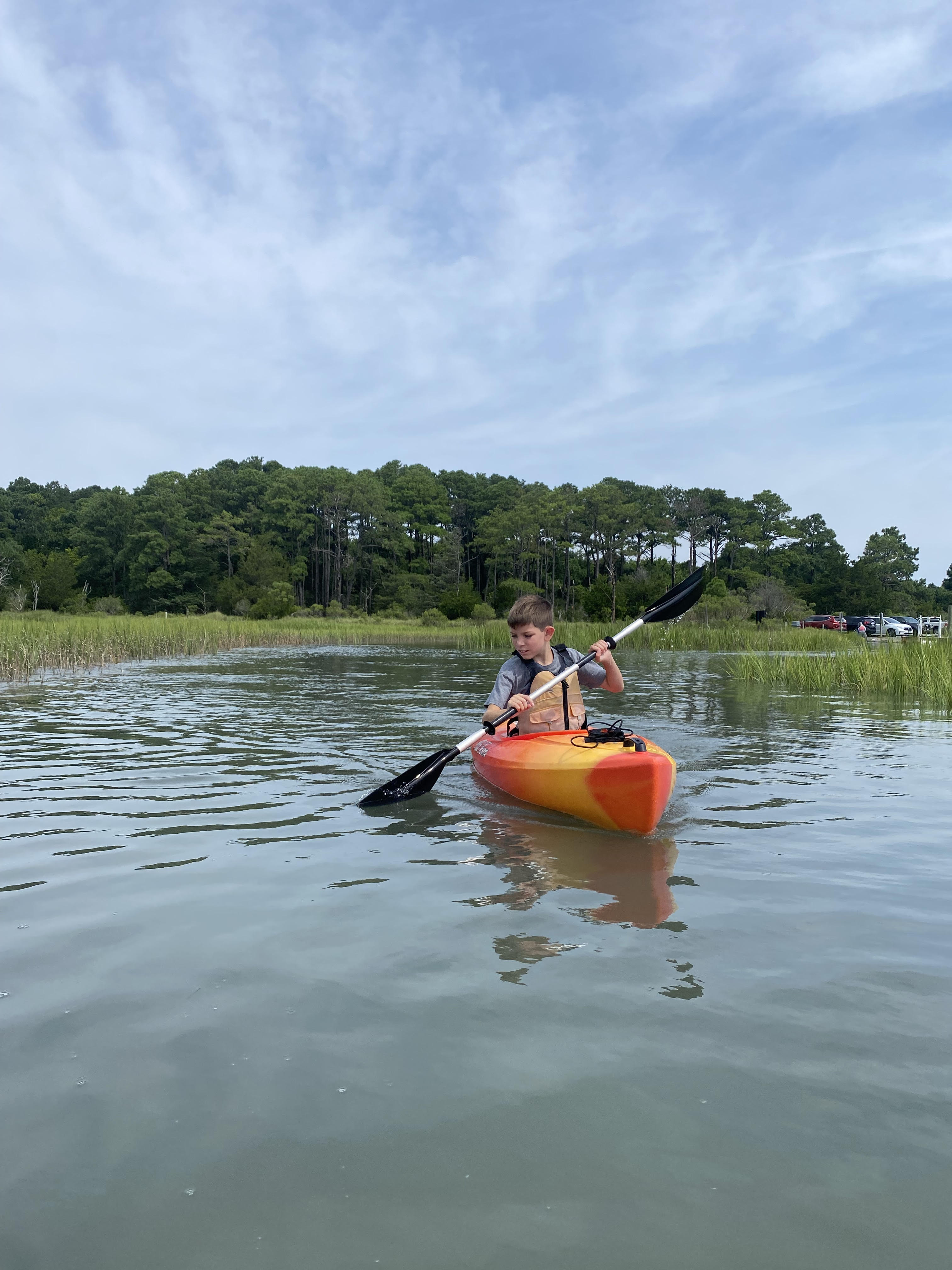
Nice forward stroke!
Paddling at Flood Tide
Conference Call!
Ready for fun
- February 17, 2024
0
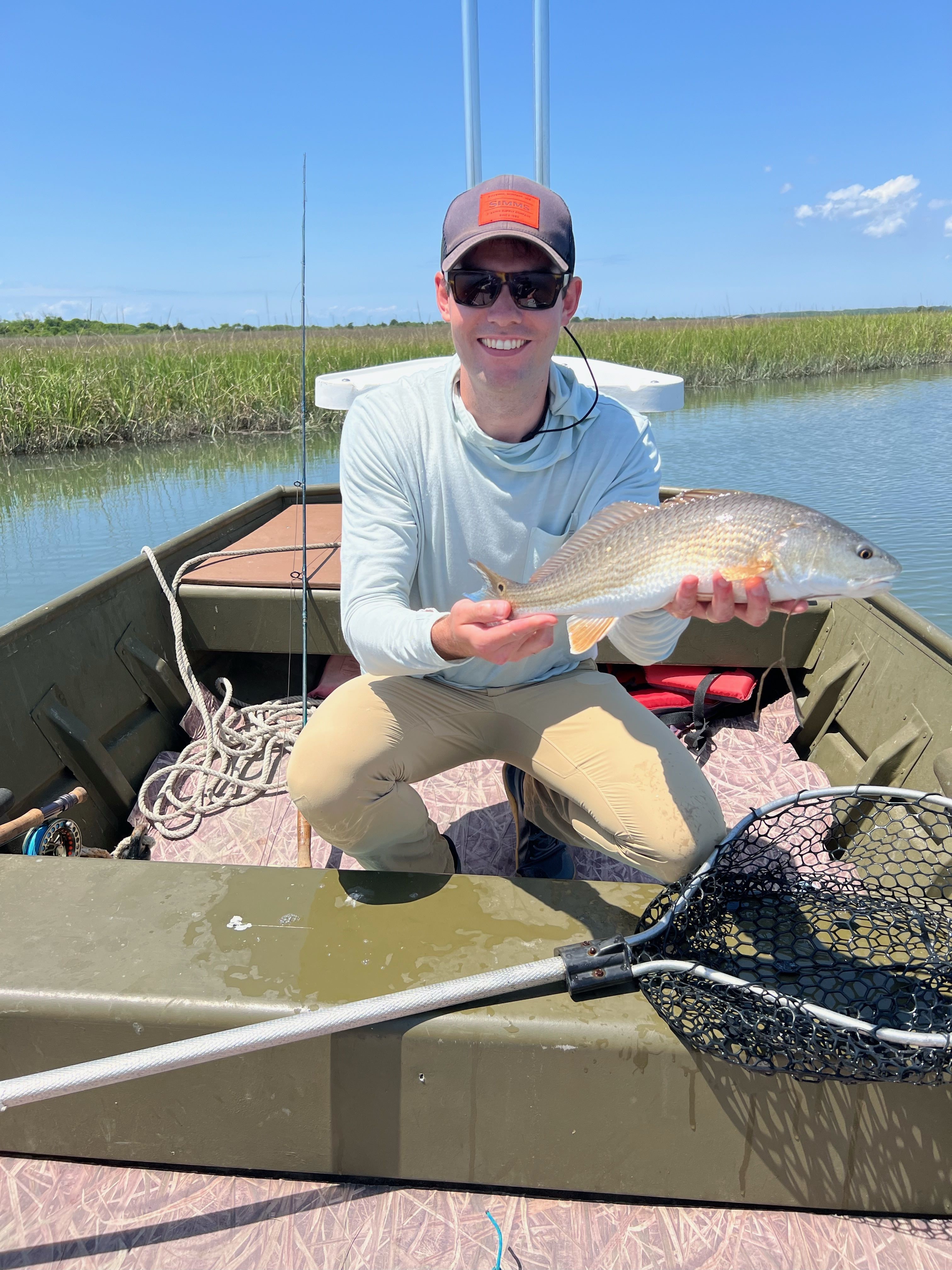
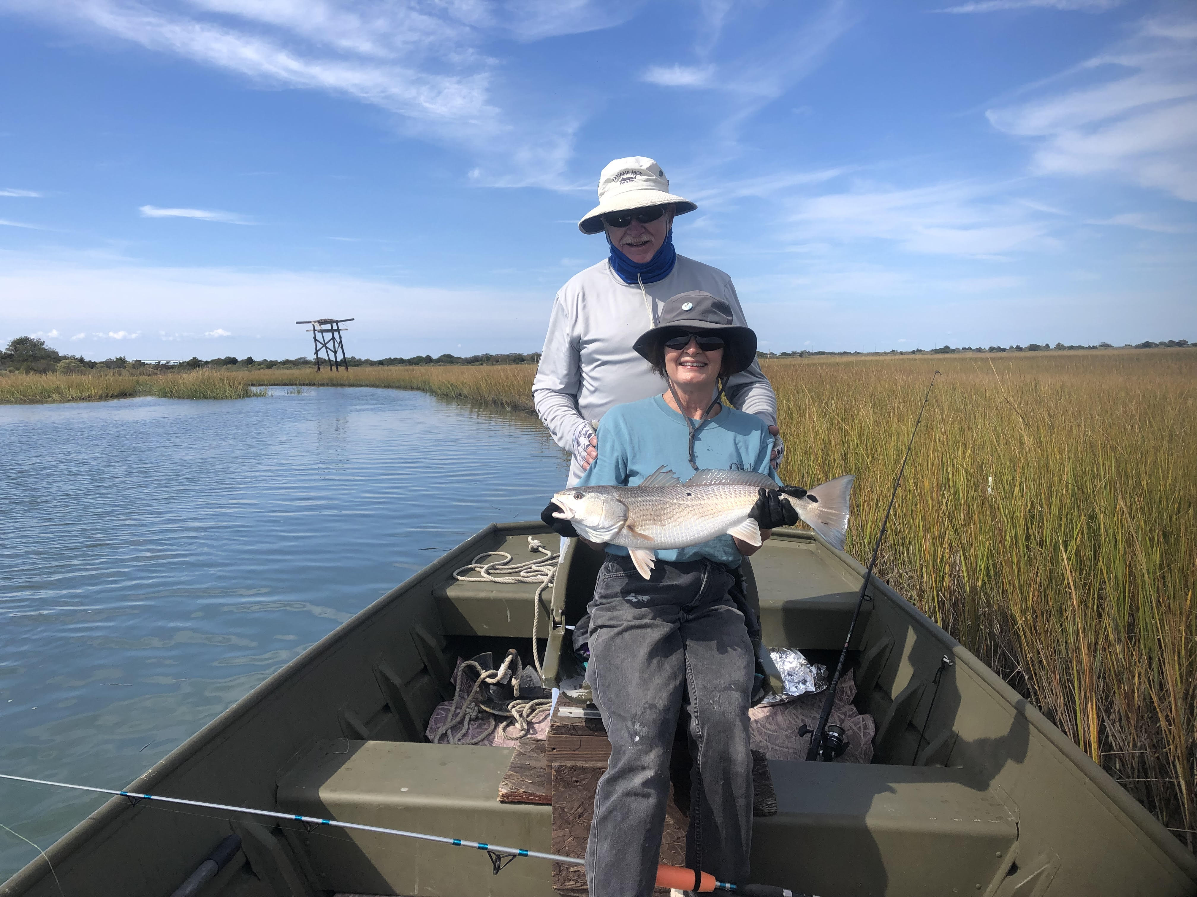
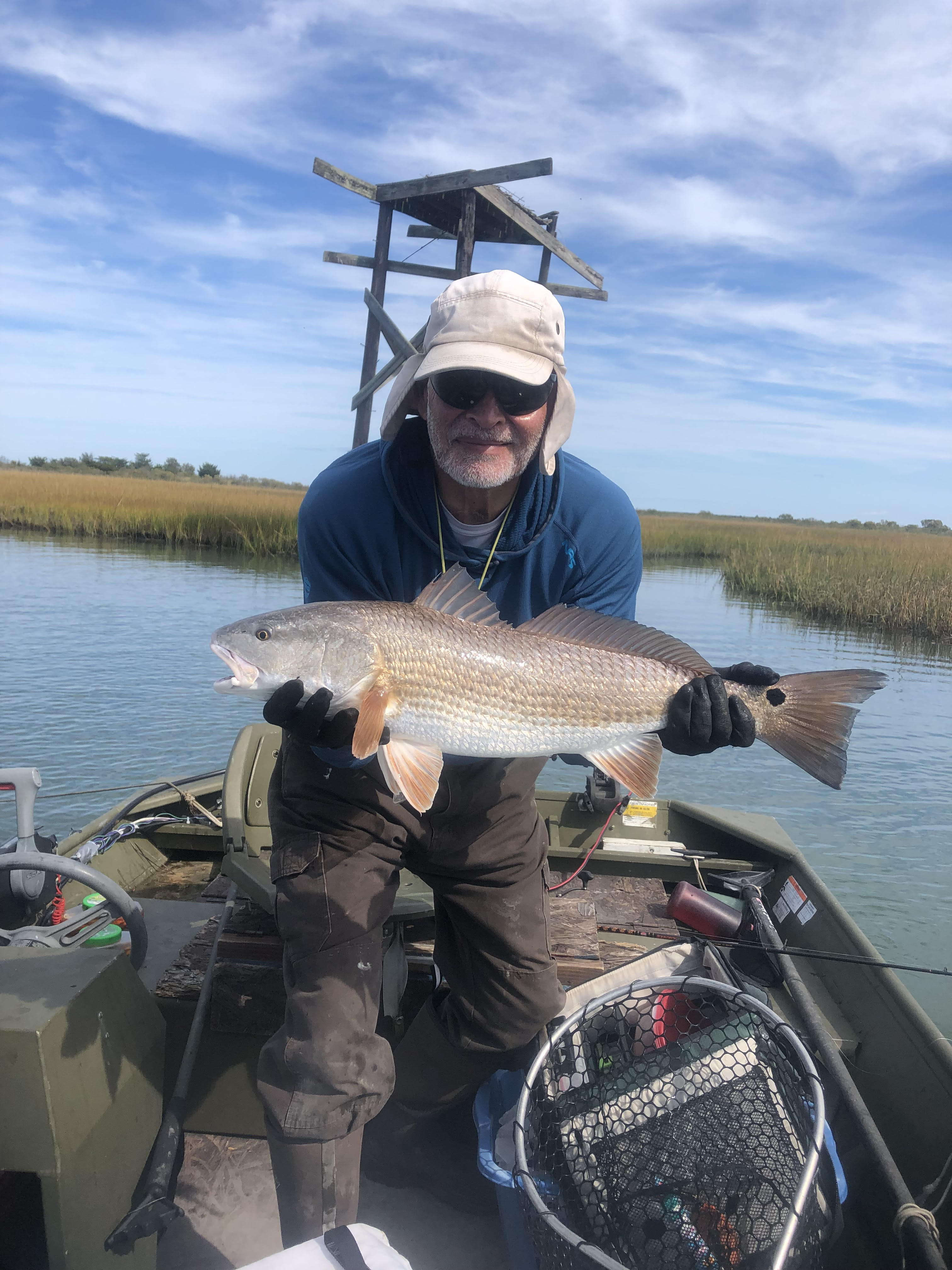
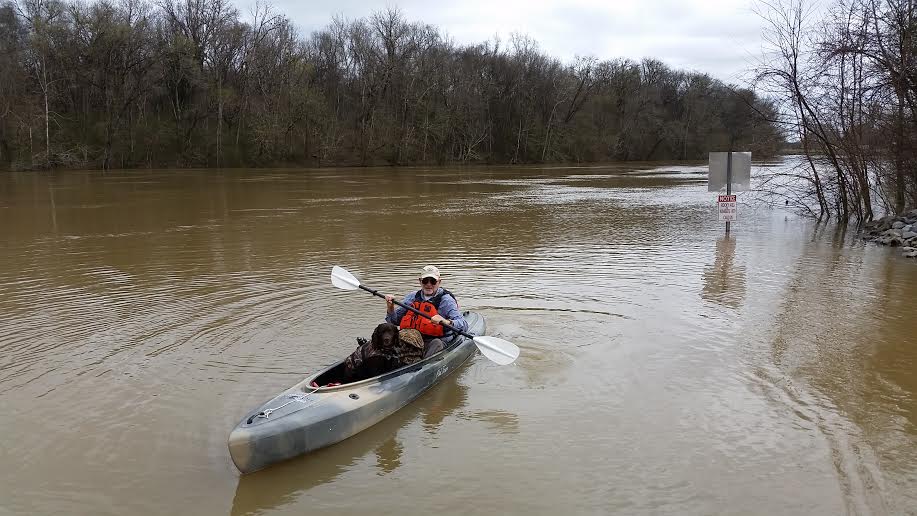
2023 Guided Fishing Charters
Category : Uncategorized
The summer of 2023 seemed different…the water in the creeks was higher and the marshes flooded more often. We had to work harder to find fish, but we managed to catch dinner most days out.
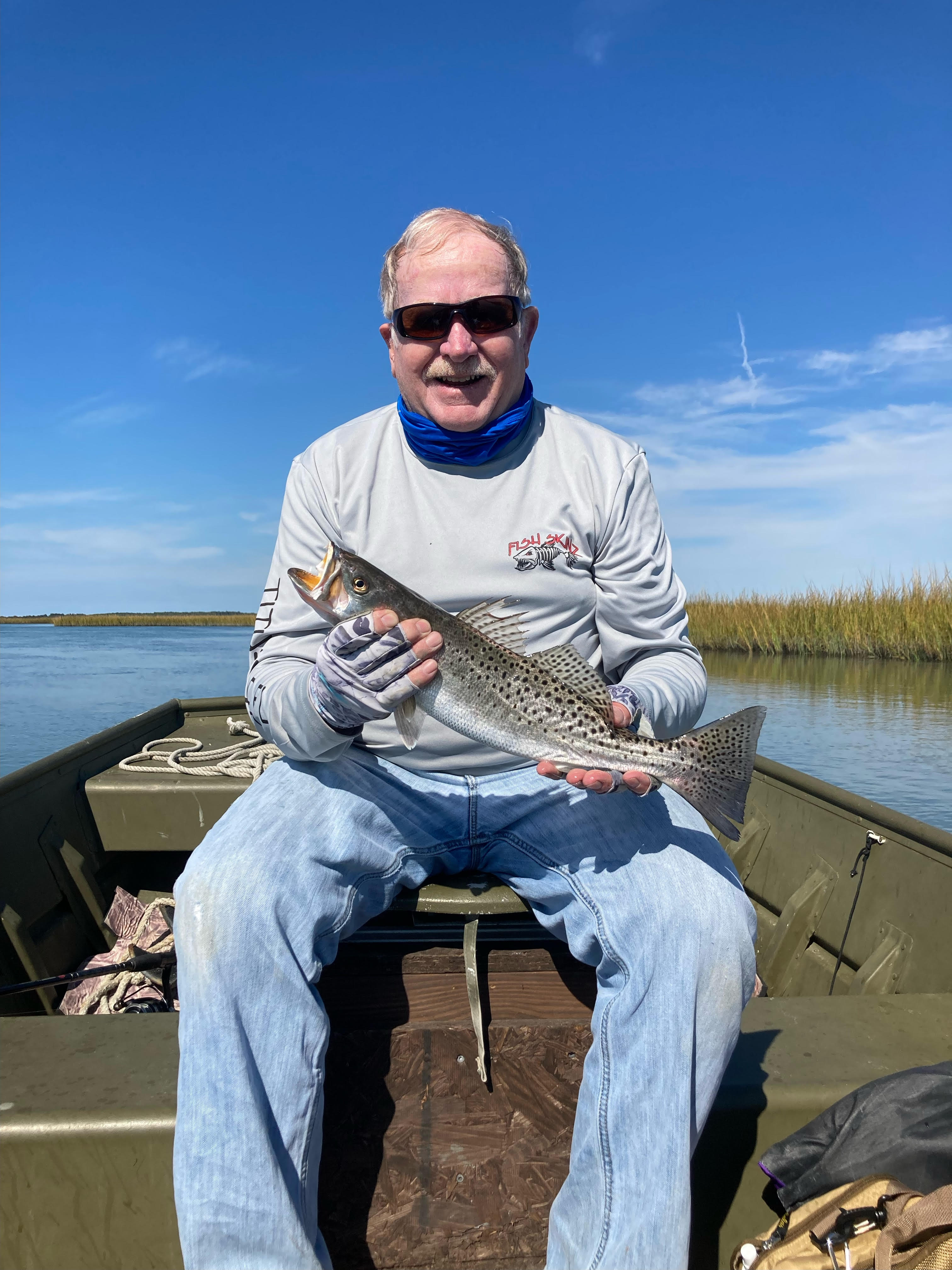
A nice speckled trout!
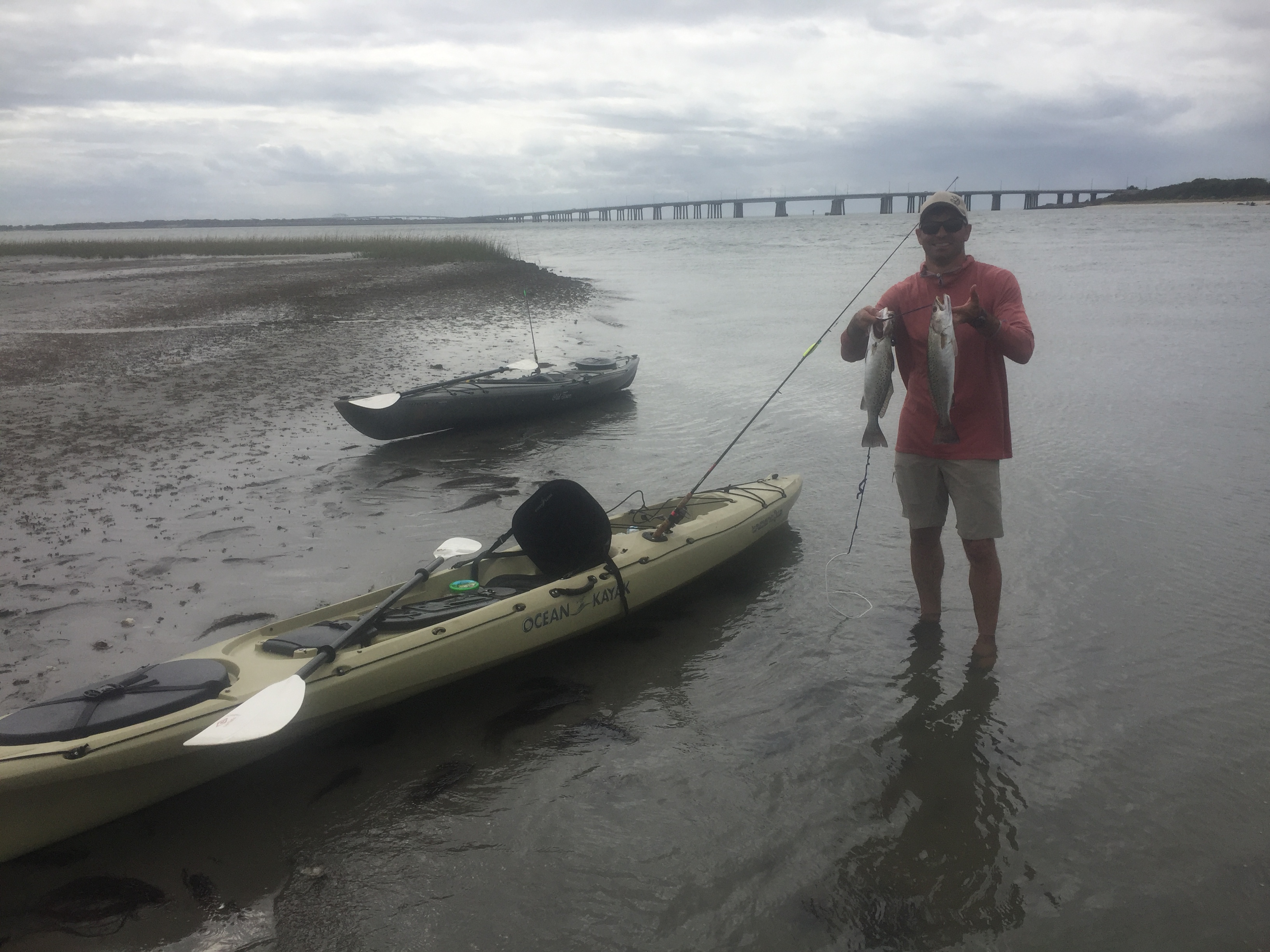
A good catch!
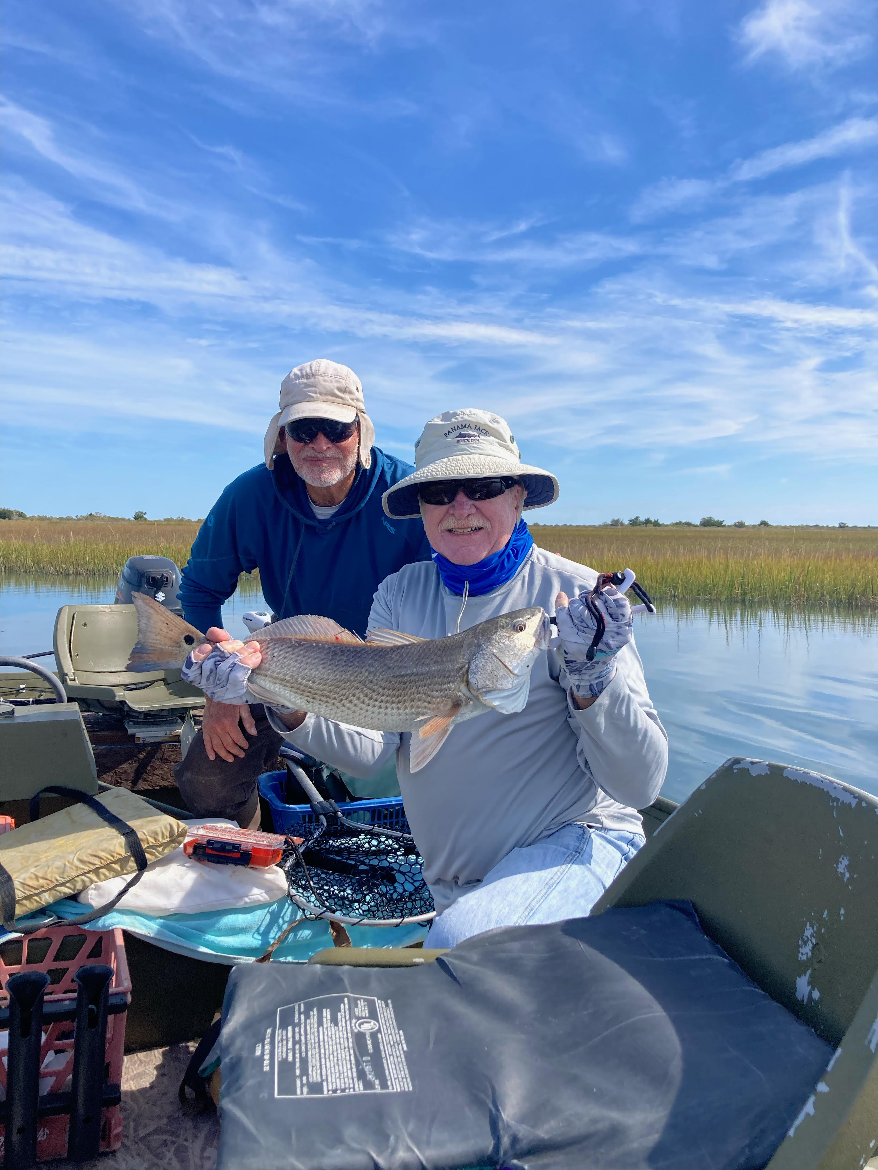
A nice redfish
Time well spent!
Too big to keep!
- February 17, 2024
0
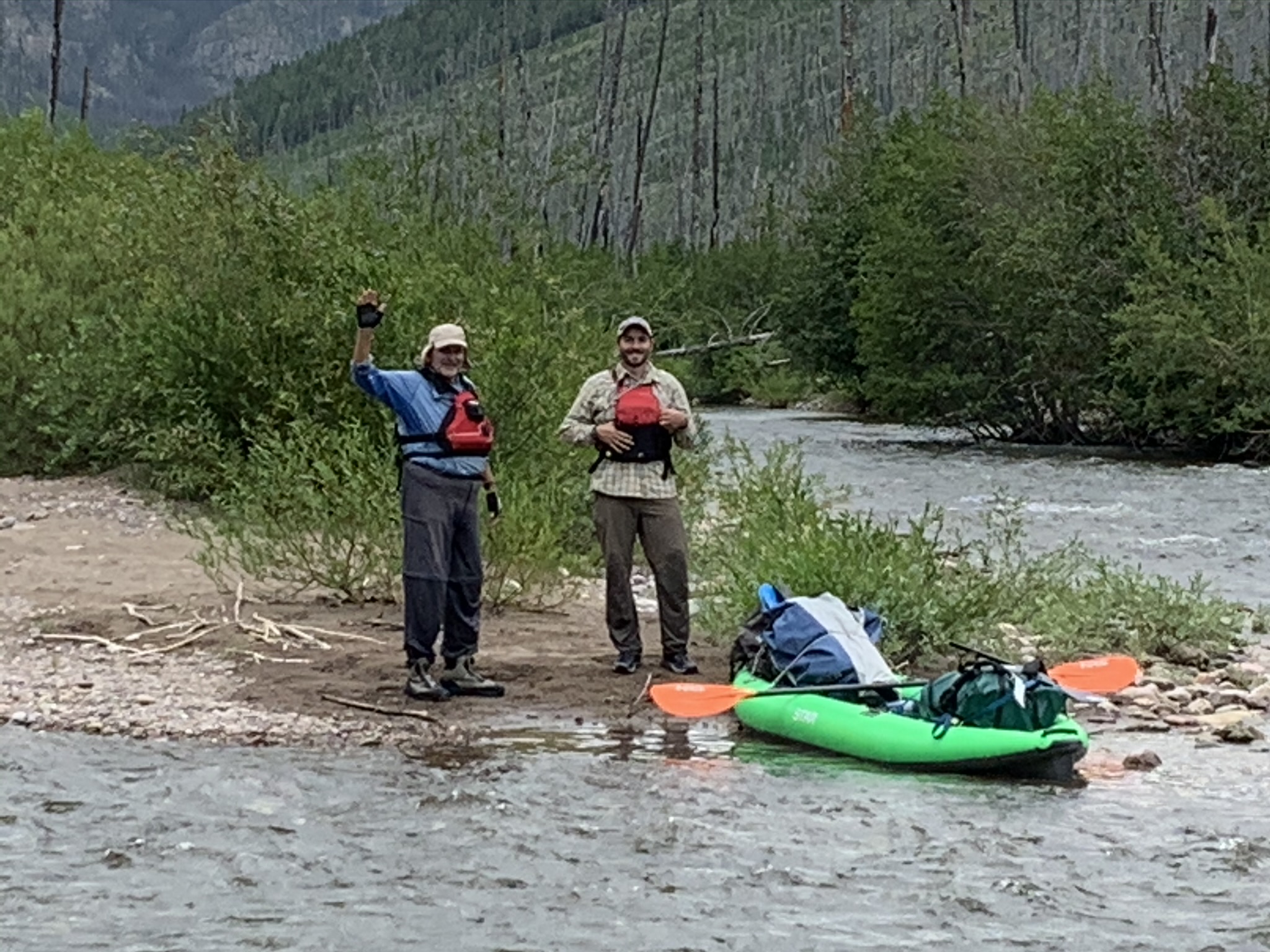
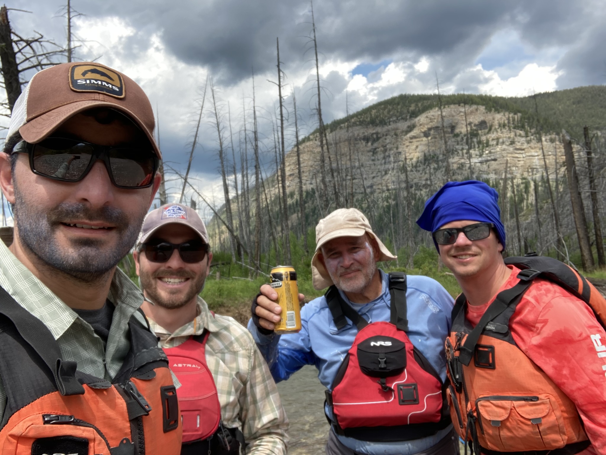
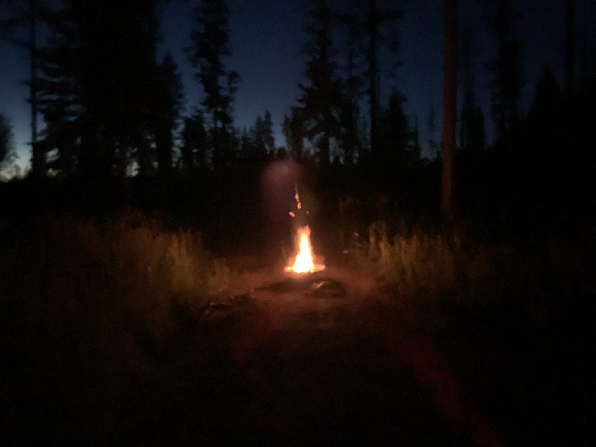
2020 Bob Marshall Wilderness Adventure
Category : Uncategorized
In 2020, during the height of the Pandemic, Tim, family and friends drove cross-country, trekked 26 miles across a pass through the mountains, and floated the Flathead River through the Bob Marshall Wilderness. The pristine wilderness, crystal clear water, and camaraderie made the 12 hour horseback ride in and the 6 hour hike out all worth it.
On the River
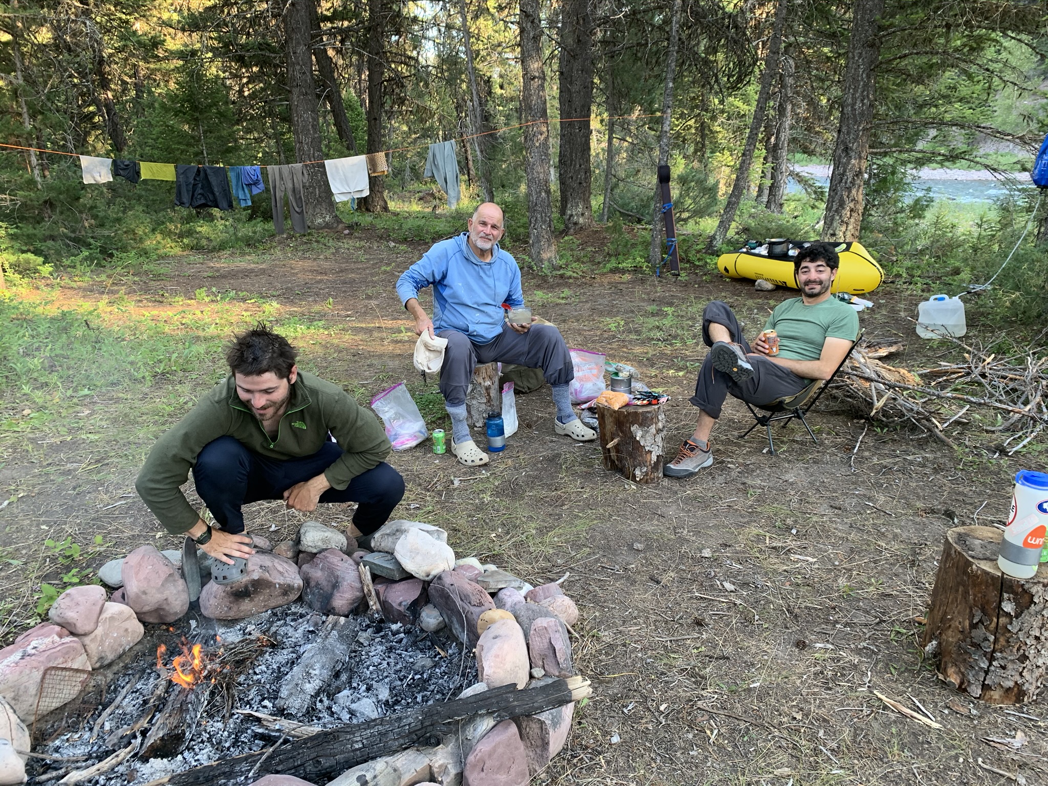
Around the campfire
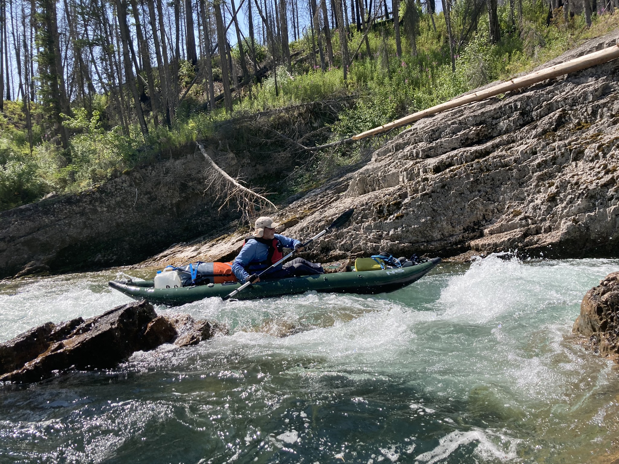
Running a Rapid
Whiskey for my friends, beer for the horses.
Hip Camp
- February 17, 2024
0
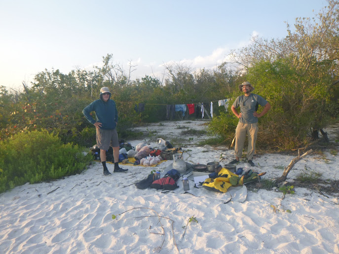
2021 Ten Thousand Island Kayak Adventure
Category : Uncategorized
In 2021 Tim was luck to participate in an Outward Bound Sea Kayaking Adventure for Veterans. Tim launched from base camp with a group of US military veterans and spent 6 days, paddling, camping, navigating with map and compass, and exploring the amazing Florida Everglades backcountry. Deepest thanks to Outward Bound NC for making this trip possible.
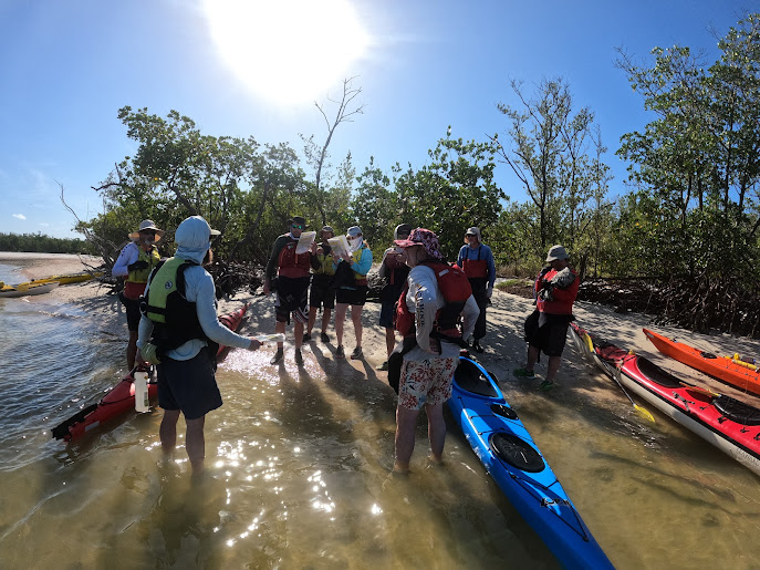
Preparing to Launch
Cook Site
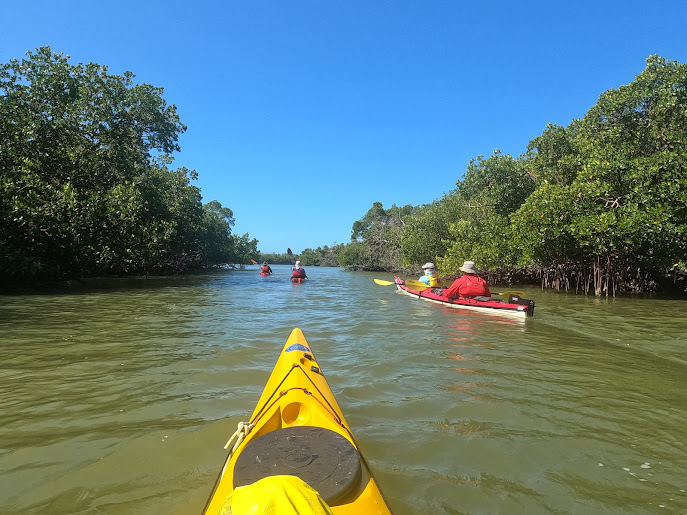
On the move
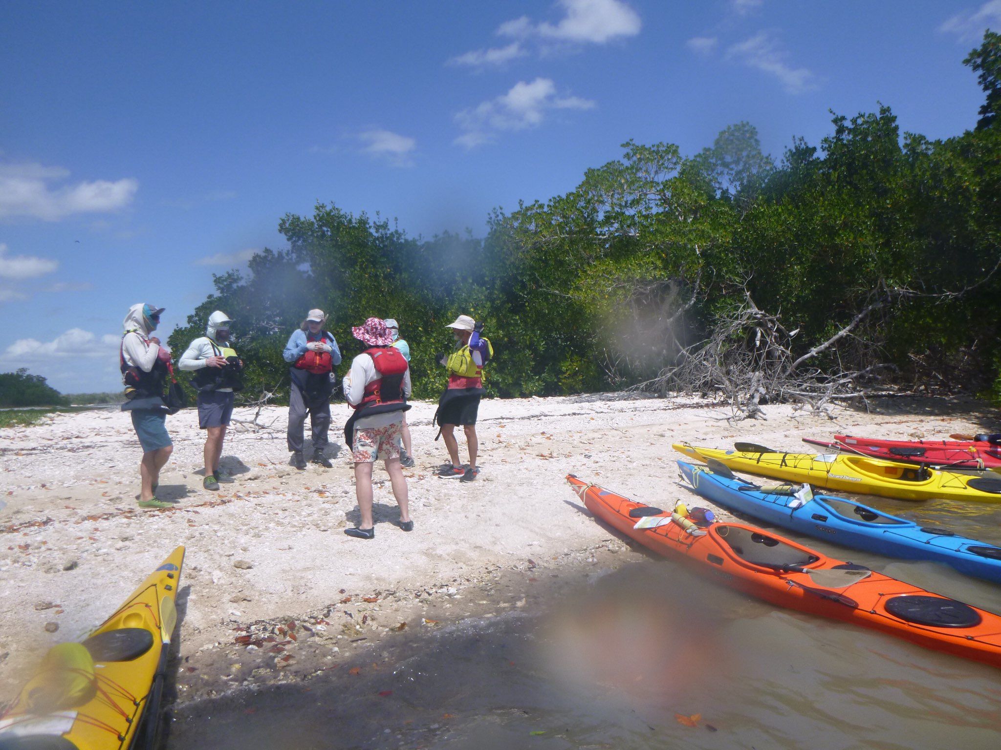
Route Planning
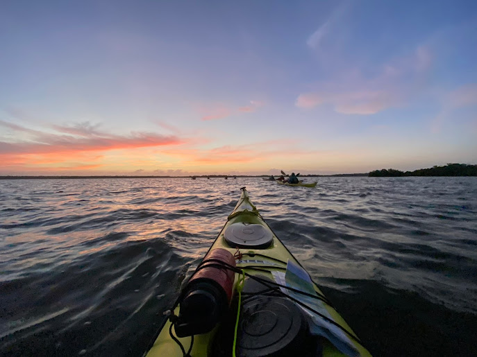
Sunrise
Dockside Sunset
- February 17, 2024
0
2022 Birding Adventure
Category : Uncategorized
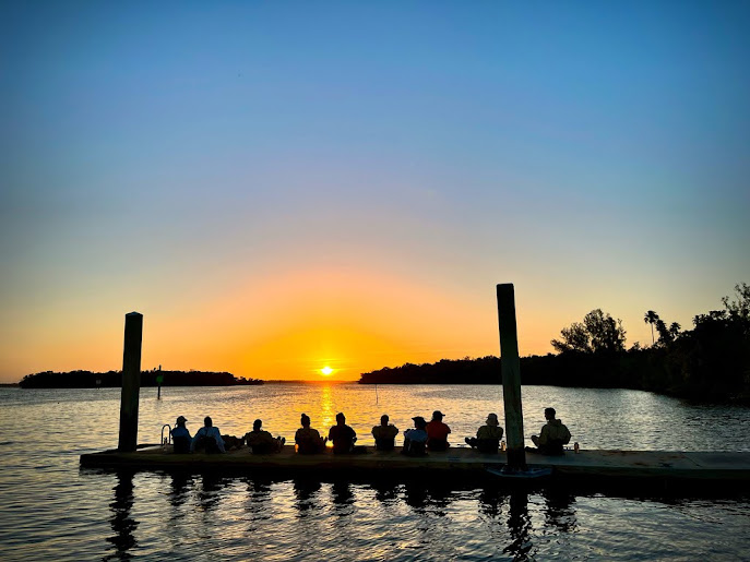
The fall migration peaks in October. Tim had the privilege to guide a group of dedicated outdoor enthusiasts on a full day tour of the creeks and marshes of the Eastern Shore National Wildlife Refuge
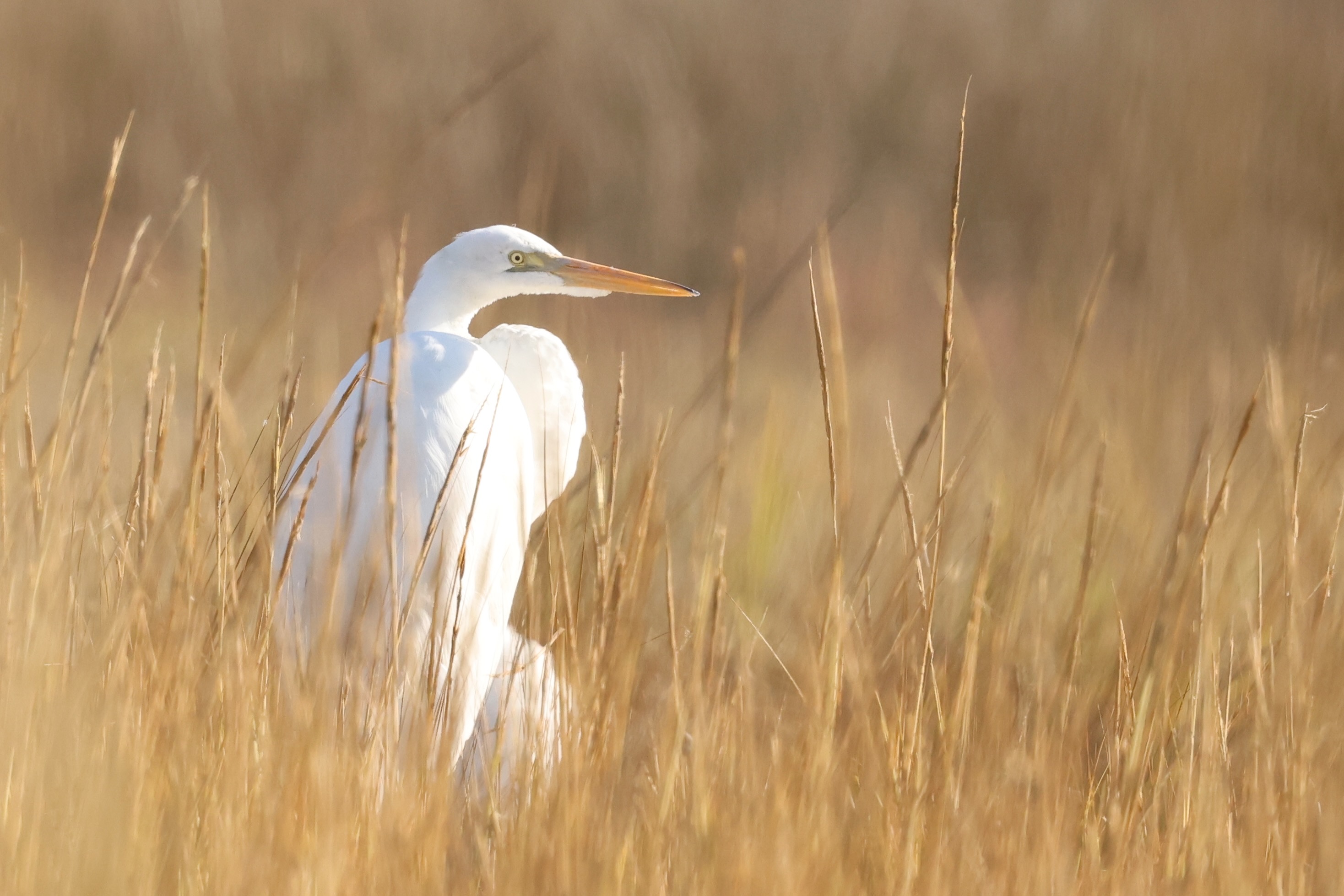
Great Egret
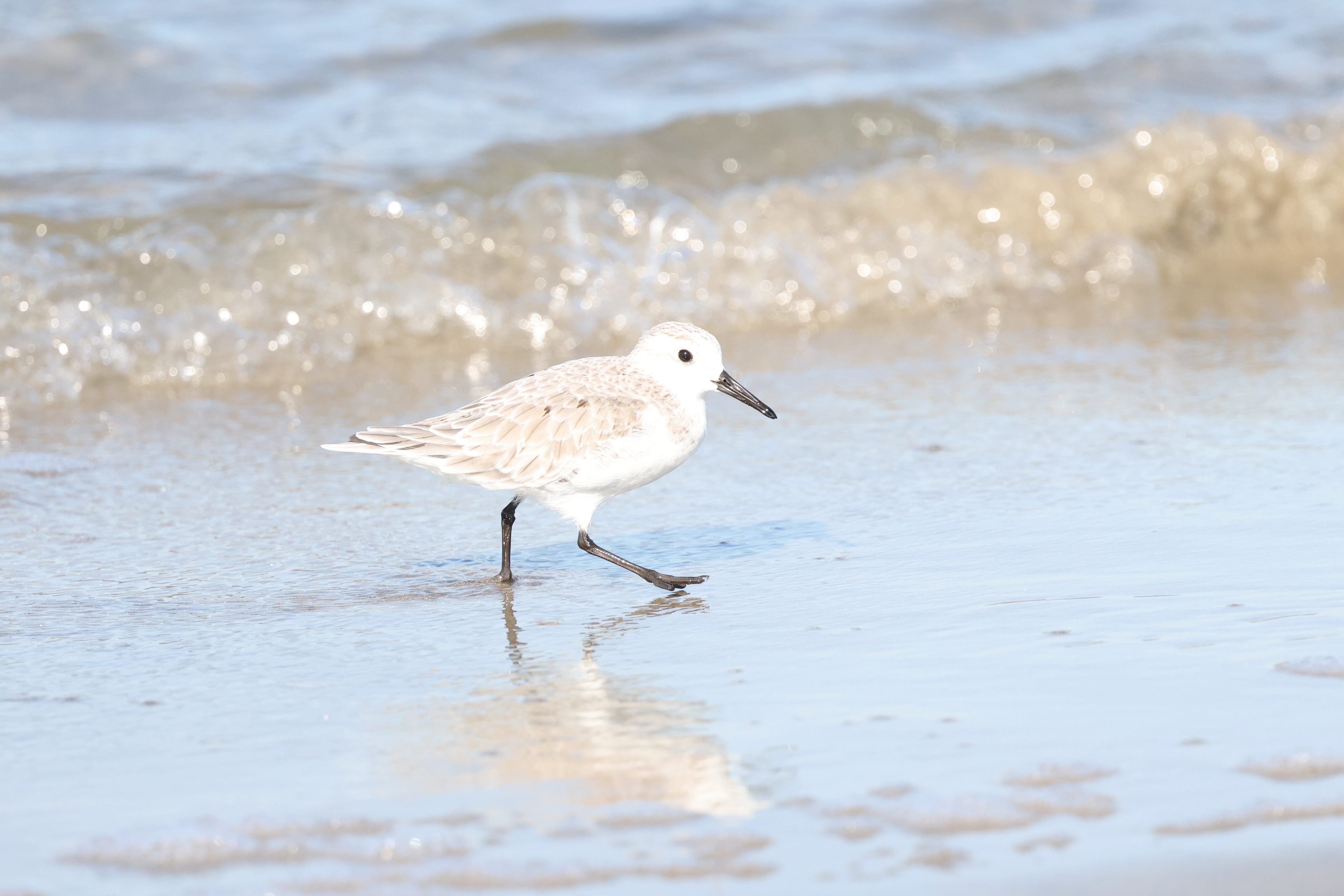
Sanderling
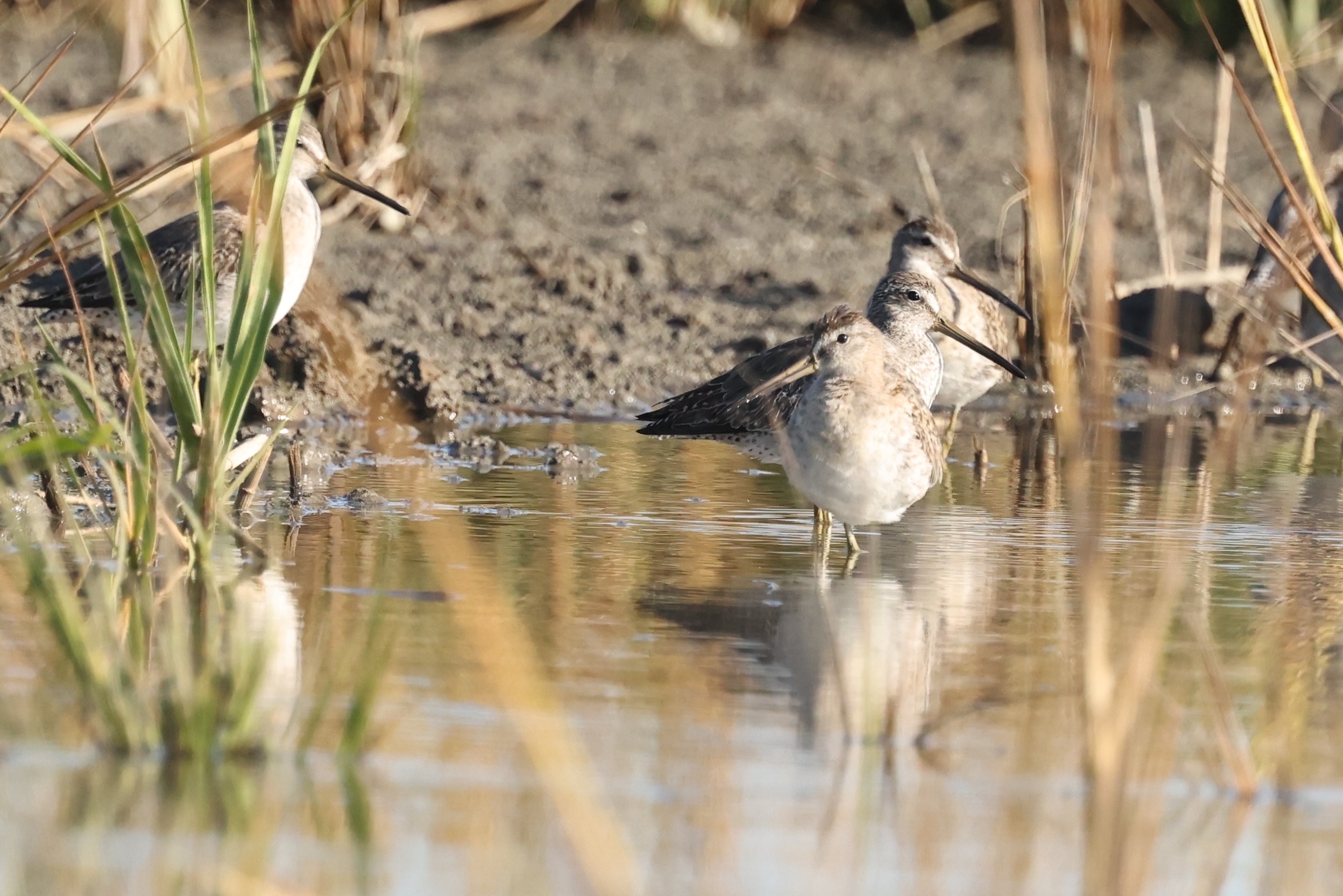
Short-billed Dowitcher
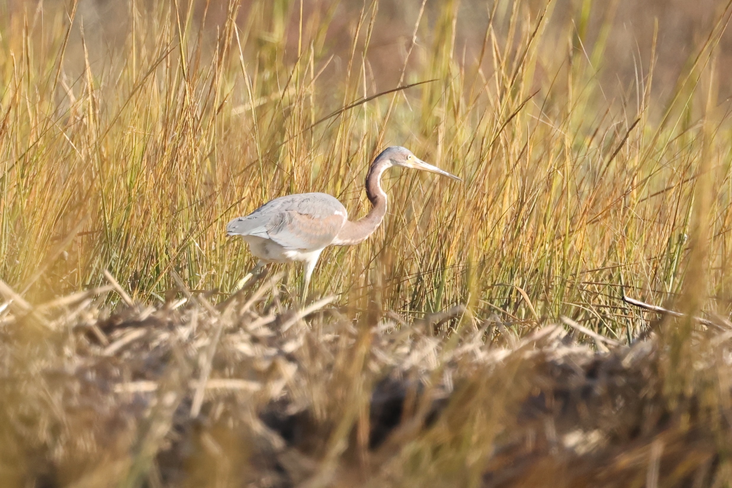
Tricolored Heron
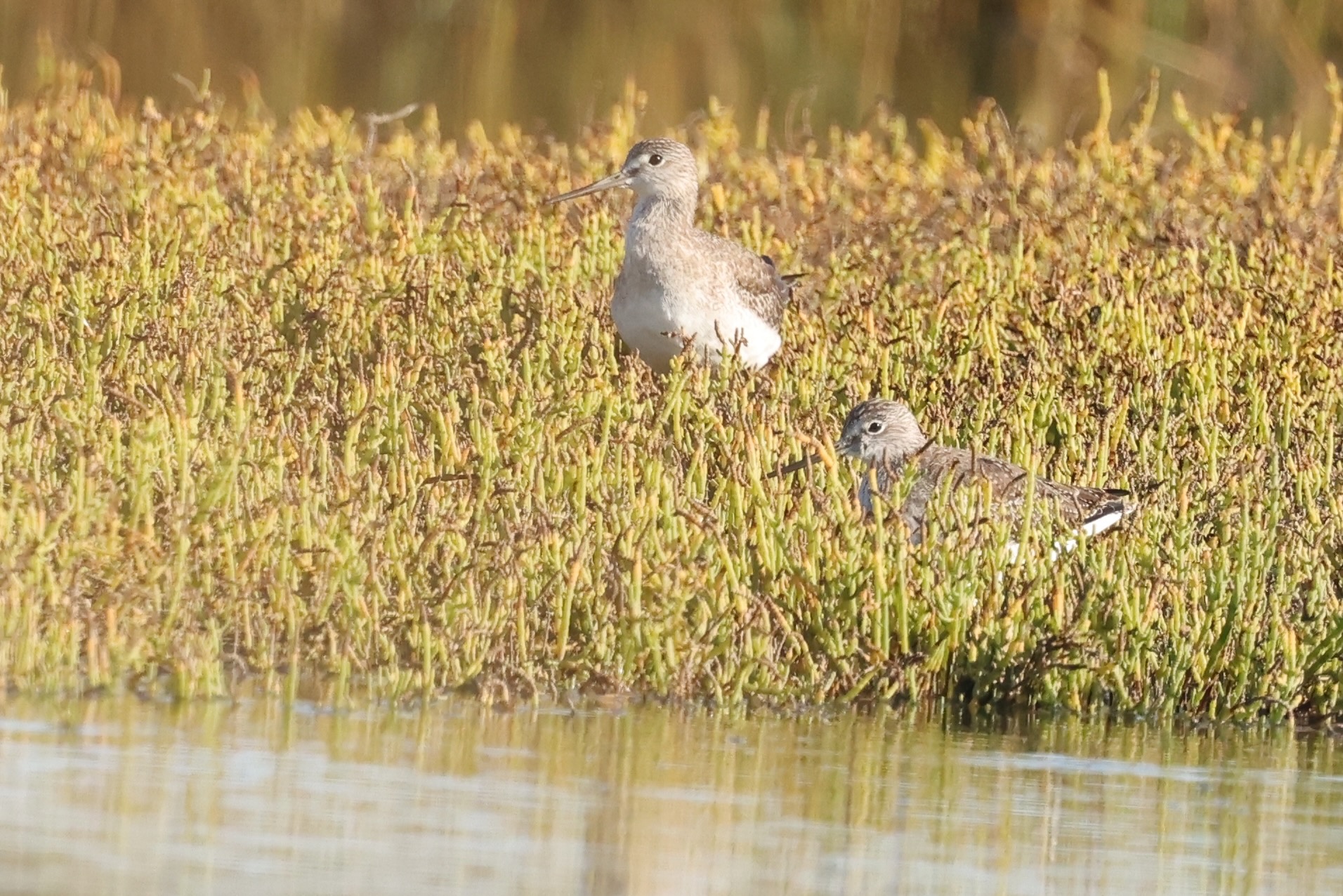
Yellowlegs
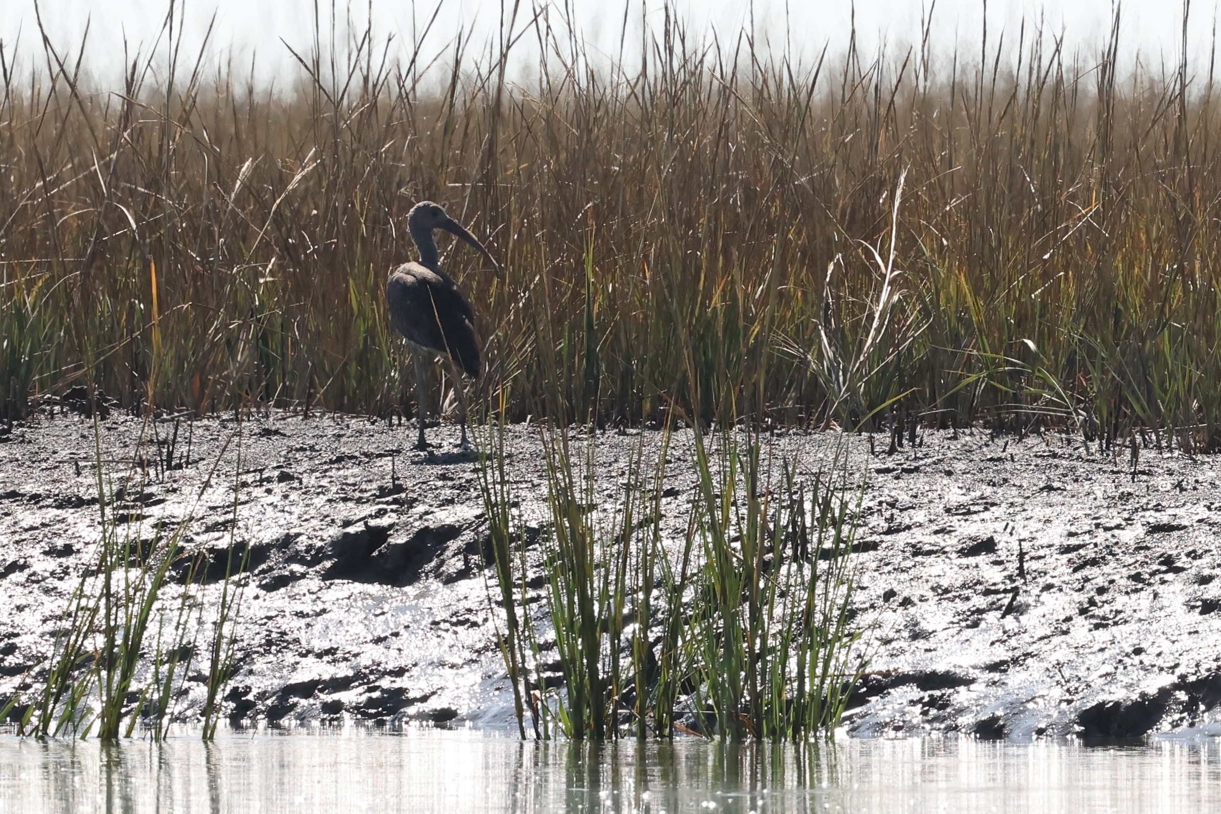
Glossy Ibis
- April 28, 2016
0
April 2016 Circumnavigation of Fisherman Island
Category : Kayaking Tales
Trip Log – Circumnavigation of Fisherman Island – April 2016
Launched from Wildlife Refuge boat ramp at 1030, and paddled southwest down the intra coastal waterway toward Wise Point. With a good outgoing tidal current I reached the southern tip of Raccoon Island in a ten minutes. A mild breeze was coming the south, the surface of Fisherman Inlet was nearly flat, no waves. I began paddling southeast across the bay toward Smith Island Inlet, keeping close in the channel along Fisherman Island. Now and then I stopped to cast a jig, looking for flounder.
 The tidal current carried me south around the shoreline of the Island. A school of porpoises was also swimming with the tide in the channel and I adjusted my speed to stay even – sometimes they swam beside me, other times they were in front, and sometimes as close as five yards, but never more than 50 yards away.
As I turned the corner of the Island to head due south, wind was pushing the sea over the shallow sandbars and I moved further from shore to work around heavier breaking waves. Individual porpoises jumped and twisted to one side, coming clear out of the water in front of the breaking waves.
After I paddled west with the wind on my left shoulder, the waves in the deeper channel were manageable, one to two feet in long swells, and the current was still favorable, helping me forward. I made good progress parallel to the shoreline, perhaps fifty yards from the edge of the sand beach. The four porpoises continued to swim beside me and sometimes in front. Time and again the one fellow continued to make a show, jumping clear out of the water. The feeling of paddling in the open water on a cool, sunny spring day with a fresh breeze and a helping tidal current was nothing short of exhilarating.
As I rounded the western corner of the Island and began to turn north I had the high rise of the Bay Bridge Tunnel in front of me. The surf again was heavy again as the wind pushed the sea over the shallows and I had to swing out wider away from shore. At times I had to point directly into the waves and paddle hard…I was in a cockpit kayak, and if I met a breaking wave facing broadside, the churning water could easily fill the cockpit and swamp the boat. Low tide had arrived now and the current was slack, but I had the south wind now at my back, helping push me north toward the Bay Bridge. I paused again underneath the Bridge to cast a jig around the piers.
After the bridge, the current of the incoming tide began to pick up. By the time I reached Wise Point, the current was strong enough to keep me moving when I was not paddling. I followed the shoreline up the intra coastal waterway, returning to my starting point, the Wise Point Boat Ramp. With the right tides and a favorable wind, a paddle around Fisherman Island is about a 4 hours, and can be a memorable day. The trip does require some skill to navigate areas of heavier breaking waves, and also confidence as a swimmer and definitely a life vest and safety gear. However, I doubt the surf is any heavier than Virginia Beach on a day with a gentle breeze. Remember that landing anywhere on Fisherman Island is prohibited. The Island is a federal wildlife refuge. (photo is from Virginia Pilot photo library)
- April 22, 2016
0
Roanoke River 5-day Kayak Tour
Category : Kayaking Tales
Trip Log, Virginia Coast Ecotour trip down the Roanoke River, March 12 – 17th
Accompanied by my intrepid water spaniel Blue, I launched in early afternoon at Weldon, NC on March 12th to begin a 120 mile solo, unsupported kayak trip down the Roanoke River. The river was high with spring runoff, boiling over submerged rocks, and we made good time, cruising past overhanging tree branches still bare of leaves but ripe with buds, their trunks buried in several feet flowing river water. After 15 miles, we reached our first planned stop a half hour before dark, a screened camping platform maintained by the Roanoke River Partners (RRP).
We broke camp early and repacked our kayak, learning ways to fit gear better into the dry bags stowed under the fore and aft decks. At 1430 we pulled into a small creek with a grassy bank for lunch, and then started down the river again. At 1500 rain hit, heavy at times, but with light winds and no lightning. We paddled through – the continuous paddling kept me warm even though I was soaking wet. Just before dark I found a campsite on state gamelands…very low and wet ground outside, but inside the tent we were dry and warm. At 1900 another rainstorm hit, this time with heavy thunder. I listened to the storm until it eased up, surveyed out gear to make sure we would not be flooded out, and then slept until dawn. We started again at 1000, with only 16 miles to travel and the river flowing at nearly 4 mph, we reached our next campsite by early afternoon – another RRP facility with a 16×16 screened shelter and large attached deck. What an awesome delight to be able to hang out all the gear still wet from the storm to dry in the spring breeze. Rains were heavy again at night, but we were warm and dry in the shelter.
On the morning of day 4 the sky was still overcast and I decided to wear waders and my gortex jacket as insurance against another rain storm. We made good time with the strong current and in the afternoon the banks of the river turned into swamps, with current actually flowing into the forest. The river made wide “s” curve bends, and as it turned back on its direction to flow the opposite way, water flowed out of the swamps and created strong back eddies. I had to paddle harder than I wanted to, and I made the next camping platform at 1800…just a dark. I had paddled 34 miles this day.
We took a leisurely stroll through town the next morning, and stopped to talk with local fellows on the front porch of a small bait and tackle store. As I repacked gear again, I separated out a small bag of gear I had packed but not used…a camera, marine radio, pots for cooking. In the evening the weather was beautiful, the temperature must have been near 80 degrees. I used the hammock for the first time…what a delightful way to relax. Like the waders, the hammock was worth packing and carrying for six days just to use once. The river became wider a slower each day. On the final day, as we approached Plymouth, the weather turned cool again and the sky was overcast and the wind came up. I paddled the final day straight into a headwind, and I the kayak felt as though it was pushing into the current, not running with it. I had to paddle hard for several hours straight until I slowly came around the final bend and saw the boardwalk along the river…I had arrived at the town of Plymouth, 120 miles from my starting point.